No engine, no problem … it’s a sailboat!

March 2nd

After spending the better part of two weeks exploring the Out Islands of Conception, Cat, and Long Island it was time to make our way back to George Town and to figure out where else we wanted to visit this time around.  According to the morning forecast the winds were going to be very favorable for a nice 4 to 5 hour sail across the Exuma Sound.  8 to 12 knots from the east in the morning, and then dropping to under 10 and becoming light and variable in the afternoon. We wouldn’t exactly be flying across, but at least we should be able to sail most of the way.  All we needed to do now, was start the engine, hoist the anchor, navigate out the short channel, hoist the sails, and then point the bow towards George Town and we’d be on our way.

While we were anchored in Calabash Bay for the past 5 days our solar panels had been able to generate ‘just enough’ electricity to keep up with refrigerator, power our lights, and charge our devices without having to run the engine at all.  The meter that measures the voltage and capacity of our battery system was reading just under 70% full and an overall voltage of 12.36 v. We typically like to keep the system charged to at least 80% full and an overall voltage of over 12.5v, so we were a little lower than we’d like, but it had been nice to ‘live off the grid’ for almost a week without running the engine. We knew that once we got underway, even though we’d be sailing, we’d still have the engine on for the first and last hour of the trip as we left and entered the harbors and also to help ‘top-off’ the batteries.  So again, all we needed to do now, was start the engine, hoist the anchor, navigate out the short channel, hoist the sails, and then point the bow towards George Town and we’d be on our way.

When I went to start the engine, the engine started right away but stalled after a few seconds. I’d like to say that this was unique, but unfortunately over the past couple of weeks the engine had developed a habit of stalling after we initially started it.  The “fix” to this problem up to this point had been simply to give the engine a little more throttle, hold the start button down a little longer, and let the starter turn the motor over for a few more seconds.  Usually on the second or third attempt, the engine would start and continue running fine without any further issues.  Unfortunately, that was not the case today.

After about 4 or 5 attempts to start and keep the engine running, it was obvious that I was quickly draining the batteries and wouldn’t be able to keep this up much longer unless I figured out and addressed why the engine was stalling in the first place.  Without going into too much detail, I figured that I should change the first of two fuel filters we have on the engine to see that would help the stalling issue.

So, at 8:30, after a 30 minute delay to change the fuel filter, and a few more failed attempts of holding the starter button down, we were finally able to get the engine started and continue the process of getting underway from Calabash Bay.  At 9:00 we pulled up the anchor and headed out into the channel. By 9:30 we were safely out of the harbor and were ready to hoist the sails and enjoy a nice sail across the sound back to George Town.

To hoist the sails, we turn the boat into the wind, keep the engine running slowly with just enough speed to keep the bow pointed into the wind, and then begin pulling up the sail.  Pointing the boat directly into the wind keeps the sails from filling up with wind and makes lifting the sail easier.

When the sail was about two thirds of the way up, the engine stalled again.  No big deal, we would just push the start button and restart the engine.  Not this time. When we pushed the start button nothing happened.  No noise of the engine turning over and trying to start. No clicking sound of the starter trying to engage. No noise, period.  We tried switching to the backup battery, but still when we pushed the button, nothing.

So, without the engine starting and keeping us directly into the wind, we had to work harder to finish hoisting the mainsail. We finally got it up, turned towards George Town and let out the other sail, the jib, so that we could cover the 20 miles or so across the Sound as quickly as possible.  Fortunately, the wind was still in our favor, so we set our course, and Diane proceeded to sail us to George Town while I went below to see if I could figure out why the engine wasn’t starting.

Since the engine hadn’t run long enough to top off the batteries and the batteries were running low from all the earlier attempts to start the engine, we turned all the electrical systems off on the boat except our radio so that we wouldn’t be draining them any further. Since it was a sunny day, with the majority of the electrical loads turned off, our solar panels would be better able to charge the batteries.

It was a great day for a sail, and Diane did a superb job of sailing us across the Sound. I spent most of the trip down below in the engine and battery compartments checking and cleaning any connection I could find between the batteries, the starter, the starter switch, and the engine.  Eventually, I could hear one ‘click’ when Diane depressed the start button, but nothing else. It was apparent to me, that I wasn’t going to be able to fix this underway, and that we would need to sail the entire way into George Town without the help of our motor, including anchoring.

Even though, Eos is a sailboat, and is more than capable of moving us from point A to point B using sails only, as you’ve probably noticed from previous blogs we’re not shy about using our engine to help us along our travels. Additionally, like most sailors, using the engine helps us ensure we can safely leave or approach a dock or anchorage since the engine gives us the ability to better control and maneuver the boat at slow speeds.  In all our years of sailing, we’ve sailed off the anchor several times without the assistance of our engine (for practice), sailed into our slip without the engine once (on our previous boat the engine wouldn’t start but we had two other people on board to help with line handling and dropping the sails), but we’ve never sailed anchored under sail power only.  So today would be a first for us. But first we had to get to the anchorage.

As I mentioned previously, the winds were very favorable for this trip, and we had timed our arrival to the cut (passage into the channel) so that the tides and winds would be running in the same direction which should hopefully allow for a less challenging approach.  It ended up that our planning did in fact pay off. The wind was sufficient to allow us to maintain decent speed and the current was in fact flowing into the channel and not impeding our progress.  So, we made our way out of the Exuma Sound, through the North Channel Rocks Cut, and into the Elizabeth Harbor Channel without incident.

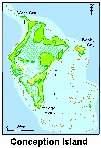
Once we were safely through the North Channel Rocks Cut, we still had to sail approximately 4 miles up the channel to where we would anchor.  Since we didn’t know what was going to be involved with getting the engine/starter repaired or how long it was going to take, we decided we should anchor as close to town as possible. That way, if we needed to dinghy back and forth into town for parts or assistance we wouldn’t have too far to travel.  Also, the anchorage directly in front of town tends to be less crowded than the ones across the harbor that are closer to the beaches and the cruiser hang outs.

As we made our way up the channel we talked through the steps and sequence of steps we would take to safely anchor without the aid of the engine.  The two big challenges we had to face anchoring with sail only seemed to be directly opposed to each other. First of all we needed to be able to maintain enough speed to be able to safely maneuver around any other boats in the anchorage. With the wind speed beginning to pick up this didn’t seem like it would be a problem.  The other challenge we had was that we needed to be able to stop the boat fast when we dropped the anchor so it would have time to set or dig in, before we moved right past it. 

To stop the boat, we were going to need to simultaneously do three separate tasks with only two of us onboard.  First, we needed to turn directly into the wind and keep the boat on that course so the wind would not fill the sail. Second, we needed to immediately drop the sail so it wouldn’t refill with wind and begin moving the boat again. And finally, the third thing we had to do was to actually drop the anchor so it could set and hold us in place.

As we got closer to our planned anchorage we were pleased to see that it was in fact not very crowded so maneuvering around the other boats wouldn’t be too much of an issue.  Now we could concentrate on finding a good spot to stop the boat and drop the anchor. Diane would be on the bow to drop the anchor, and I would be on the helm to turn into the wind when directed, and then move to the companionway and drop the mainsail.

Diane spotted a good place for us to anchor and pointed to where I needed to head. I turned the boat into the wind, our speed slowed as planned, and I was able to quickly drop the sail most of the way down. At the same time, Diane lowered the anchor, let out some additional chain and just like that we were safely at anchor. Easy-Peazy, just like we planned it.  Luckily, the increasing wind helped to set the anchor as we drifted backwards. It’s nice when a plan comes together.

Now that we were safely and securely anchored I quickly got back to the task of trying to figure out what I could do to get the engine started or at least remove the starter so I could go look for a replacement in the morning.

It took awhile, but I was finally able to remove the starter.  Before I went to look for a replacement, I decided I’d take the starter apart and see if I could ‘see’ what was wrong with it.  Once it was out, it really didn’t take much to disassemble it.  My visual inspection really didn’t reveal much to me, although I did take the time to clean the internal parts prior to re-assembling.  After putting the starter back together, I decided I’d re-install it and see what would happen.

With my head still buried in the engine room, I hollered up to Diane to have her push the start button.  I must admit, I really didn’t expect anything to happen, but low and behold when she pushed the button the starter whirled, the engine turned over and started. Again, after a few seconds though it stalled again.  If you remember earlier in this post, I mentioned that I only replaced one of two fuel filters on the engine when it wouldn’t start in the morning.  So now it was time to replace the second filter in the system. The first one is intended to catch and filter out any coarse contaminates, and the second one is much finer and catches anything the first one doesn’t. Typically replacing the coarser of the two addresses most problems, but it was now obvious I needed to replace the finer filter as well.

Once that was replaced, we were able to start the engine and it ran without stalling.  So apparently, we had two issues today. One was the primary issue, fuel filters that were not allowing enough clean fuel to the engine. The secondary issue was the starter. Because the engine wouldn’t start easily, we ended up overheating the starter and it wouldn’t turn or got stuck. By disassembling the starter and cleaning the internal components, the starter was able to, once again, work properly.

We’re going to still see if we can find or locate a spare starter, but for now the problem is solved. We’re safely in port, and ready to relax for a few days.

My nemesis of the day

Long Island

 February 24th – March 2nd

The passage from Cat Island to Long Island would be approximately 40 to 45 miles – initially 10 miles due west out of the anchorage and then another 30 miles due south to clear Cape Santa Maria, the northern most point on Long Island, and then another few miles south, south east, into our planned anchorage in Calabash Bay.

We started our engine shortly before 7 am and had the anchor up and headed out the channel by 7:15 am.  Since we were still travelling with our other two buddy boats and they were both still faster than us, we wanted to make sure we got an early start so we might have a chance at not being the last boat in the anchorage this time around.

As it turned out we got underway about an hour before everyone else and since there wasn’t much wind throughout the day, everyone pretty much ended motorsailing throughout the day. Consequently, we were able to maintain our slight lead and were actually the first boat in our group to reach the anchorage.  In full disclosure and to be fair to the other boats, shortly after reaching Cape Santa Maria the other boats decided rather than passing Eos and leading the way into the anchorage, they slowed down a little so that we could lead the way in. 

Entering a new anchorage, it’s always nice to follow someone else in so that they if they encounter any shallow water or other hazards that aren’t marked on the charts they can pass the information on to the other boats in the group. So, it was our turn to lead the group in.  Fortunately, even though there weren’t any navigation aides (bouys or day markers) the approach was fairly well marked on our charts and we were able to follow the recommended course in without any issues and were anchored just after 4 pm in beautiful Calabash Bay and headed ashore to check out the beach. 

Long Island is an appropriate name for this island. It’s almost 80 miles from north to south and never gets much over 4 miles wide, so it seems to stretch on forever.  The majority of the settlements and anchorages are on the western shore with the exception of Clarence Town which is about two-thirds of the way down the island on the east coast. 

Long Island

Long Island was originally settled by the Lucayans who named the island ‘Yuma.’ With the coming of Christopher Columbus’ landfall in 1492, he renamed the island Fernandia after the King of Spain who had financed his voyage. The island’s name was changed a third time to Long Island by an unnamed seafarer who said while sailing the island took a very ‘long’ time to pass – hence the name.

We ended up anchoring right in front of The Cape Santa Maria Beach Resort & Villas (Capesantamaria.com) and were able to not only frequent the restaurant a few times during our stay but also able to get assistance from them in renting a car and information on any ‘must see’ local attractions. 

Cape Santa Maria Resort and Beach Club, Calabash Bay

The resort and beach face directly west, and with nothing to obscure the horizon at sunset we were able to see our first ‘green flash’ at sunset. The green flash is an optical phenomenon that you can see shortly after sunset. It happens when the sun is almost entirely below the horizon, with the barest edge of the sun – upper edge – still visible. For a second or two, that rim of sun will appear green in color.

For our first full day on the Long Island we rented a car to explore many of the sights the staff at the hotel recommended we visit.  (Rather than reinvent the wheel, many of the following descriptions of the attractions we visited that day come directly from the literature they provided us)

Our first stop of the day was Columbus Harbor and the “Bridge to nowhere” at the far northern most end of the island. The road ends and there is a rather nice, newly constructed footbridge the crosses the cut. Once you cross the footbridge, there is literally nowhere else to go. There is a path that leads to the tip of the island, but again, there’s not much there to see.

After visiting nowhere, we turned the car around and travelled just a few miles south to the Columbus Monument. The monument was constructed by the Long Islanders Association as a tribute to the arrival of Christopher Columbus on October 17th 1492. Long Island was the second land that Columbus discovered in the North Americas. The monument reads: “The monument is dedicated to the gentle and peaceful and happy Aboriginal people of Long Island, The Lucayans, and to the arrival of Christopher Columbus on October 17th 1492.”

The monument itself was very nice and sitting up on that hill and looking out to sea and the rocky coastline it’s hard to be impressed with the skill and seamanship it took to cross the ocean and avoid wrecking his ships on the rocks that surround the island.

Our next stop was St. Mary’s Church and a fresh water shrimp hole. The church is said to have been built in the 17th Century and is the oldest church on the island. Located just a short walk behind the church is a series of fresh water ponds and caves that are filled with thousand of small red shrimp. The lighting wasn’t best for viewing the shrimp so it wasn’t the most impressive attraction we visited that day.  However, the church alter did have a little sign on it that said “Give Thanks”. That was a wonderful little reminder in the middle of nowhere.

On a side note, as we travelled south it seems that every few miles we would run into a small church and unlike those on Cat Island, these appeared to still be active churches. Throughout the day we must have seen close to hundred small churches and with a population of just over 5,000 people one would have to concluded that the people of Long Island must be pretty faithful!

After leaving St. Mary’s and the shrimp hole, we continued south to Hamilton’s Caves.  To access the caves you first have to call ahead and then meet at a small house right off the highway. Once there, the tour guide, typically Mr. Leonard Cartwright the property’s owner, will have you follow him back up the highway and to an unmarked road and entrance. From there, he gives you a private tour and supposedly tells lots of stories about the cave’s origins, the history of the Lucayans that occupied them, and how he and his brothers used to play in those caves as kids. Unfortunately, the elder Mr. Cartwright was off the island that day and our guide for the tour was his wife. She did a nice job walking us through the caves, and showing us the highlights, but our tour was also filled with lots of ‘my husband usually takes people back in that section, but I can’t get back there’ or ‘my husband can tell you more about …’

The structures within the caves themselves were fascinating, and although we didn’t get to hear all the stories or explore some of the areas, we did really enjoy our tour.

After a lunch stop, we headed to the world famous Dean’s Blue Hole just north of Clarence Town. Dean’s Blue Hole is the world’s deepest blue hole, plunging 663 feet to the bottom of the Atlantic Ocean. The Blue Hole is oval at it’s surface with a diameter ranging from 80 to 120 feet. Descending 60 feet the hole widens considerably into a cavern with a diameter of up to 330 feet. Today it’s the site of Free Diving World Championships and other free diving competitions. If you feel like diving down past 274 feet, unassisted, on a single breath, you can stake your claim as the new world record holder! (Given that I have a hard time getting and staying down below 15 feet for very long, I can’t imagine the breath control and skill it takes to descend several hundred feet!)

We did take time to swim in the Blue Hole and were quite impressed with the water clarity and all the marine life we saw along the walls of the hole.

After drying off in the sun, we all got back in the car and headed over to Clarence Town to check out the harbor/marina just in case we ever found ourselves traveling down the east coast of the Island and needed a place to stop.

While in Clarence town we also visited the beautiful twin churches that Father Jerome (remember him from our blog about Cat Island?). He first designed and built St. Paul’s Anglican Church and then after converting to Catholicism, he designed and built Saint Peters Catholic Church.

By this time, it was starting to get late in the day we wanted to make a stop by the grocery store on the way back to Cape Santa Maria while we still had the rental car.  So, we turned around and began our trek north. The Hillside Grocery store in Tompson Bay was one of the best stocked stores we’ve come across in the Bahamas. We grabbed some fresh fruit, scored a pack of Thomas English muffins (should have bought two), and bought a pack of Klondike Ice Cream bars to share with everyone once we got outside and before continuing our drive north.

We refilled the car with gas and returned to the resort somewhere between 5 and 6 pm.  It was a very full, but enjoyable day touring the island. We didn’t get all the way down to the southern end, but we don’t feel like we could have packed much more into a single day island exploration.

On Friday the 26th, one of our buddy boats departed and headed back to George Town as he had guests flying in on Monday that were staying with him for a week. One of the things we’ve enjoyed about this trip has been the opportunity to meet new people and make friends. While we were sad to see him leave and ‘break up the band’ we’d enjoyed traveling around together for a few weeks, and know our paths would cross again sometime in the future.

Our plan was to spend the next few days just hanging out and enjoying the beach and anchorage and then probably head back to George Town on Monday and begin making preparations for our slow trek north through Exumas.

Early Saturday morning while doing some light cleaning on the boat, I managed to ‘tweak’ my back again.  It’s something that has happened to me periodically over the past 5 or 10 years, so we both pretty much know the routine. Spend the first day laying flat, apply some ice, take lots of Avil, and then over the next few days start walking and stretching as much as possible and avoid bending or lifting.  That routine has worked well for me at home, but was a little more difficult to implement while living on a boat (which pretty much mandates an active lifestyle throughout the day).

So, we ended up spending all day Saturday and most of the day Sunday simply resting onboard and doing as little work as possible. It was again very windy so staying onboard wasn’t so hard. This seemed to do the trick, and by Monday I was starting to feel much better.

After checking in with us to make sure we wouldn’t require any assistance to make our crossing our buddy boat got underway and headed back to George Town on Monday.  We were able to spend time ashore and floating around in the dinghy exploring Hoosie Harbor the rest of the day.

Monday evening we took our time making sure everything was stored properly and that we’d be ready to head out after breakfast in the morning.

Officially crossed into the tropics while driving south on Long Island – almost time to turn around and start heading north!

New Bight

February 19th – 24th

We reached our anchorage in New Bight just before 4pm and dinghied to shore to grab a bite to eat from one of the food stands in the local ‘fish fry’ area.  Having spent a year or two in the mid-west, when we heard the term ‘fish fry’ we were expecting an actual dinner of fried fish like they would have each Friday evening in Milwaukee.  Well, New Bight isn’t Milwaukee and the term ‘fish fry’ doesn’t apply to an actual meal, but rather an area along the road/beach with lots of little specialty food stands. 

Here in New Bight, the fish fry area had a conch salad stand, a hamburger stand, two or three small restaurants, and a small beach bar or two. We enjoyed a great dinner at Hidden Treasures restaurant. Unfortunately, we were the only ones enjoying a good meal.  Our food arrived shortly before sunset, and as the sun began to go down, the bugs/no-see-ums began to come out!  The proprietor of the restaurant could tell by our constant slapping and scratching that the bugs were enjoying a meal too, so she brought over a can filled with coconut husks and pine straw and tossed in a match.  ‘Once the fire dies down, the bugs will all go away and leave you all alone. If they don’t, we can add some more husks to the can and relight it!’

Fish Fry Village on Cat Island
Fish Fry Village – roadside view

While the smoke screen did provide some protection from the bugs, it didn’t really enhance the flavor of the food, which didn’t need enhancing at all.  We all polished off our dinners as quickly as we could, settled up our bills, and smelling of smoke, headed back to our boats to get away from the bugs.

The following day we took a hike up to highest point in the Bahamas, Como Hill, which stands 206 feet above sea level and also happened to be the sight of the retirement home of one Father Jerome.  John Cecil Hawes, known to the locals as Father Jerome,  was an architect turned Anglican, then Catholic, priest.  He was born in England in 1876 but later moved to the Bahamas where he had his hand in building or restoring churches throughout the Bahamas. His unique stamp of hurricane-proof stonework with its thick walls and barrel-vaulted roofs can be seen throughout the islands. He eventually settled on Long Island (our next stop) and ministered to the people there. After an interim elsewhere as a wagon train driver, a monk, a missionary and horse breeder, he became a Catholic priest and returned to the Bahamas to build Catholic churches and the St. Augustine Monastery in Nassau.

On Father Jerome’s first approach to New Bight in 1937, he immediately selected Como Hill has the spot for his retirement home. As one walks up to his ‘hermitage home’ from the base of the hill, one is struck not only by his gift for architecture, but also for his genuine and humble devotion to God, which carries all the way up the hill through his Stations of the Cross, past the replica of Jesus’ tomb with it’s rolled away stone to his spartan living quarters and small chapel for private devotions. (The history of Father Jerome and Comers Hill was copied almost verbatim from our Explorer Charts cruising guide)

(Pictures of some of the Stations of the Cross at the Hermitage)

Looks like Father Jerome’s sun dial is still working!

On our return from Como Hill we passed several fields filled with ‘volunteer’ vegetable plants – volunteer in that they looked wild and scattered about rather than planted and cultivated in neat rows.  There was however a local man who was picking tomatoes & beans from some of the plants in the back corner, so I approached him and asked if it was ok if we picked some as well. He said no problem, help yourselves. So we each picked a few and then left some money on the seat of his car for letting us take some of his vegetables.  We then proceeded to walk to the other end of town to pick up a few bottles of wine to restock our supply. 

According to the locals, the store was only 5 to 7 minutes away.  After walking for nearly 15 minutes, some in our group beginning to question the directions we had been given.  After another 5 or 10 minutes walking we did manage to reach the store and pick up some wine and spirits.  We must have looked fairly exhausted because one of the clerks volunteered to drive us in the company pickup truck back to where our dinghies were parked several miles back in town.  We gladly accepted the ride.

The ‘boys’ had to ride in the back of the truck on the way back from the store while the ‘ladies’ got to ride up front in style!

Once back to the beach we loaded our vegetables and loot into our dinghies and headed back to our boats to unpack and grab some lunch before rejoining on shore later in the afternoon to hike to the other end of town to the grocery store. When Diane and I got back to the boat and unloaded our stuff I realized that I was missing my iPhone.  I had taken a ton of pictures of Father Jerome’s Hermitage, and remember pulling it out to use as a flashlight while looking into a cave that was just off the trail, but don’t recall where I would have left it.

We went to shore to look around the area that our dinghies had been parked, thinking it might have fallen out of my backpack … no luck. We went back to the store to see if we left there or in the back of the pickup truck … no luck. We walked along the road from the store to the dinghy landing area thinking perhaps it could have fallen out during the ride … no luck. 

Over the next two days we retraced our steps, including several sweeps of the garden, the Hermitage, and the hiking trails around the Hermitage and never did find the phone.  Since its a US number and we’ve been using another phone with a local sim-card and Bahamas phone number, my phone has been on airplane mode with no cell or data service, so it’s not like we could call it or even use the ‘find my phone feature’. I’ve since changed all my passwords, temporarily suspended my 818-6686 number, and have everything set up so that the phone should wipe itself and become locked, if it ever reconnects to either cell or wifi service. Oh well, I was looking to upgrade my phone later this spring anyway!

In addition to spending time looking for my phone, we spent the next day, Sunday, at anchor, riding out another strong cold front that was moving through the area.  The winds were blowing in the low 20’s most of the day, and gusting into the 30’s.  The skies were overcast with occasional rain, so it was a good day to stay put.

On Monday we rented a car for the day and toured the island. Actually, we picked up the car at 11 am, so we didn’t need to return it until almost noon the following day.  We headed north and explored the northern end of the island.  We stopped and had lunch at a nice little resort that overlooked the harbor … beautiful view and good food. After that, we took a nice long hike to the northern most end of the island and then got back in the car for our trip back south to New Bight.

It’s snowing in the Bahamas! (Actually it’s saltwater foam blowing off an inland lake, but sure looks like snow. We were tempted to try to make sea-salt angels but knew we’d be soaking wet the rest of the day

On our drive home, we kept looking a road that would allow us to cross from the western side to the eastern side of the island so that we could get a good glimpse of the Atlantic.  Even though the island is only a mile or two wide, we didn’t find any roads that transversed the island on the northern part.  We found several dirt ‘paths’ and attempted to make the crossing two or three times, but the path just kept getting skinnier and bumpier the further we traveled east, so we would eventually turn around and continue our journey south.

The ‘road’ was too bumpy for a good photo .. but hopefully you still get the picture

We finally made it back to the dinghy landing and parked the car at the police station for the evening. We figured that was one of the safest spots around to park a car. The worst thing that could happen was that we’d get ticketed … but fortunately the parking lot wasn’t posted and we were able to park the car there overnight without incident.

Since we didn’t have to have the car back to the rental car agency until close to noon, we decided to all head to shore around 7 am, and spend a few hours exploring the southern end of the island. 

We met as planned, all piled into the car and headed south.  We enjoyed our morning exploring that part of the island and on our way home, did manage to find a road that would take us to the eastern shore.  The road did turn into more of a ‘path’ for one stretch,(mid route we noticed it was labeled “rocky road” in tiny letters on the map) but then eventually widened again and we were able to find a gas station to refill the car before finally returning it close to noon.

After our early morning adventure, we all needed to get some rest so that we could be prepared for the evening’s festivities. 

The night before, upon our return from the northern end of the island, we met an older gentleman, Pompeo Johnson, who was hanging around Duke’s Conch Shack in the fish fry village.  Pompeo had joined us for a domino’s match that evening and then invited us to join him and his band the following evening for some traditional ‘rake and scrape’ music.  Not exactly sure what we were agreeing to, we said we’d be delighted to join them. Just tell us the time and place. 

So at the appointed time, 5 pm the following evening, Pompeo and two ladies treated all cruisers and any locals that wanted to join in to a concert.  Pompeo sang and played a small accordion, while one lady played a drum and the other played a handsaw. Yes, a handsaw.  Apparently the ‘scrape’ part of rake and scrape refers to keeping time and providing a beat by ‘scraping’ a screwdriver along the teeth of the saw.  (I’m sure if you check out YouTube, you can probably find a video of someone preforming this type of music). The lyrics were pretty folksy and reminded me of bluegrass music.

I’m auditioning for the band!

Everyone enjoyed themselves and it was a great way to wrap up our time on Cat Island.  There may only be about 1600 people on the island, but everyone we met was very friendly and welcoming. They were very appreciative for any and all the cruisers who stopped by to visit their island.  It’s definitely on our list of places to return.

Slack-line station set up for the more adventurous tourist at the Greenwood Resort on Cat Island

Fish On!

February 17th – February 19th

After a great dinner with friends and a good night’s rest we were ready to get underway bright and early Wednesday morning.  We pulled the anchor just after 7am and pointed our bow towards the south end of Cat Island. 

Cat Island is roughly just 15 miles north, north west, of Conception Island, but we would need to travel close to 25 miles to safely clear the western corner of Cat Island before heading east and traveling another 10 miles to our anchorage.  With a total travel distance of 35 miles planned for the day and leaving just after 7am, we should be safely anchored by mid-afternoon.

We enjoyed a pleasant sail north. The winds and waves were both pushing us from behind. The seas were again probably between 4 to 6 feet but about every two or three minutes we’d get one that was ‘slightly’ bigger than the others  (8’).  When that happens, the boat picks up some extra speed and feels like it’s surfing down the wave.  (One of us really enjoys that sensation, while the other one would rather avoid it).

While sailing north we put out our fishing line and hoped we’d be able to catch some fresh fish for dinner.  Throughout the day we saw lots of flying fish sailing along, but didn’t get any strikes on our line. We cleared the southwestern end of the island and turned east for the 10 mile run into our anchorage.  With only about 2 miles to go to our anchorage I looked back and noticed that we indeed did have a fish on our line.  Diane was down below, so I hollered ‘fish on’ so that she would know I finally had a fish on the hook and that she needed to come up and take the wheel and I would hopefully be able to pull the fish in. 

We use a hand line rather than a rod and reel while sailing.  The hand line is basically just a bunch of fishing line wrapped around one of those large kite string donut looking things.  To go fishing, we simply drop the end of the line with the lure into the water and then let the line ‘unwind itself’ as the lure floats behind the boat.  Pretty easy.  To get the line back in, rather than using a reel to pull and wind the line back to the boat, we actually have to pull and wrap the line back onto the kite-string-donut-thing by hand.  Up to this point that hasn’t been too difficult since we typically don’t have a fish on the end of the line. This time it was different.

This time, with a fish on the end, pulling it in by hand and wrapping the line around the kite-string-donut-thing was a lot harder.  Diane did a great job steering and slowing the boat down just enough so that I was able to finally pull the fish in close to the boat.  At this point, although I couldn’t tell what kind of fish it was, I knew it was good sized fish.  So, remembering a trick my dad said he used to use, I asked to go down below and pour a shot of rum into a glass for me.  Actually, the rum wasn’t for me but for the fish.  Apparently to keep the fish from flopping around on the deck too much, once my dad would pull a large fish onboard, my mom would pour a shot of rum down the fishes mouth and it would ‘knock the fish out’.  This made removing the hook very easy.

So, as I pulled the fish out of the water and onto the deck, Diane had the shot glass in hand and served the fish it’s drink.  Dad knew what he was talking about.  Almost immediately the fish stopped moving and laid on the deck like it was passed out.  It’s a good thing too, because now I could clearly see that the fish I finally landed was a 3 foot Barracuda! We probably wouldn’t be eating this one. 

We took a few photos and then put the fish in the cooler to sleep off his binder while we quickly searched the internet to see whether or not barracuda were safe to eat.  Although some people do eat barracuda, the general consensus is not to eat any that are over 30” long. Apparently the larger fish accumulate the ciguatera toxin overtime and when eaten, the toxin causes rather severe food poisoning in humans. So rather than take the chance, we decided to toss the ‘cuda back overboard.

We actually managed to land another fish earlier in the day. Apparently one of the small flying fish wasn’t too good at navigation and while we weren’t looking, it ended up flying and landing on our deck. Unfortunately, we didn’t discover the crash scene until later in the day and the fish had long since taken its last breath of fresh air.  So, we tossed another one back into the ocean. One of these days we’ll land a fish that we can actually eat!

After wrapping up our fishing expedition, we made our way into the anchorage just west of the settlement of Old Bight, Cat Island and just a few hundred yards from Rollezz Restaurant and Beach Resort. Our buddy boats had arrived an hour or so ahead of us and were already on shore scoping out the area. Although the resort looked closed, they managed to run into one of the staff who informed them they would be happy to open up the restaurant for us later in the evening if we wanted to eat there for dinner. Since none of the other boats were successful catching any fish either, we all agreed that a nice dinner of local seafood would be great.

Rollez Beach Resort … Old Bight, Cat Island

We got cleaned up and headed to shore around 5:30 to enjoy the warm breeze and sunset before our 6:30 reservation.  Someone from the restaurant would come get us when dinner was ready.  So, we sat back and relaxed, and relaxed, and relaxed some more.  About an hour and half later, one of the staff finally came out and let us know that they were now ready for us. 

Dinner was definitely worth the wait. We enjoyed fresh fish and lobster, and a nice piece of delicious guava rum cake for dessert. During dinner the owner/chef came out and chatted with us. She filled us in on some history of the area and also gave us some suggestions of places to visit during our stay. She even talked us into ordering a freshly baked pineapple cake that her sister would be making for us if we stopped by tomorrow. It was definitely a nice way to start our visit.

Cat Island is almost 50 miles long, but only a mile or two wide in most places.  At it’s peak in the 1950’s the population was almost 15,000 people and they had a thriving agriculture industry on the island.  Today the population is only about 1600 people and there really wasn’t any sign of industry other than a fledging tourism business. Apparently, the plantations began closing in the late 1950’s and any industrial base closed with it.

Although there weren’t very many people on the island, there definitely were a lot of small churches.  It seems that around every corner another small church sat proudly and ready to welcome and serve anyone who happened to be in the area. 

An old Catholic church in Old Bight
Inside of the Anglican Church in Old Bight

We spent our first full day on the island walking around the settlement of Old Bight, buying bread from the local bakery, and enjoying the chance to really stretch our legs. After a long day on shore, we all retired to our own boats for a quiet evening.

Missy makes a delicious conch and grits dish that we were only able to sample because she had already sold out for the day by the time we stopped at noon!

The following day we decided to take our boats several miles north, and anchor off two small islands that were only a mile or so off the coast of Cat Island to do some snorkeling.  We moved the boats, anchored, and snorkeled around the islands for an hour or two.  While we did see some colorful reef fish, we didn’t find anything that we could snag for dinner. So, after a few hours of swimming, we got back on board and moved the boats another few miles to the settlement of New Bight, Cat Island where we would end up staying for several more days.

Allono’s bakery

Looking for Christopher Columbus

February 15th  – February 17th

We enjoyed our time in George Town for the past two weeks, but were ready to head further east or south and visit some of the less populated islands in an area our chartbooks call “The Out Islands.”  Located within this collection of islands are several of the islands that Columbus supposedly either made his first landfall, anchored just off shore, or actually spent some time on the islands. 

While we were not going to be able to visit all of them this trip, we did have a few in mind that we wanted to visit: Conception Island, San Salvador, and Long Island.  If the weather cooperated, we’d hopefully get to visit those on this trip.

Based on the current forecast, we made plans to leave George Town just after sunrise, and travel the 40+ miles east to Conception Island as our first stop. We got up early Monday morning, made a good breakfast, completed all our pre-departure tasks, and pulled anchor right at 7am as planned and headed Eos out into the channel.

During our time in George Town we had met cruisers from three other boats that had expressed interest in spending some time in the Out Islands and possibly traveling together.  Conception Island is approximately 40 miles east of George Town and unlike other passages the entire passage would be in open ocean rather than traveling just a few miles offshore and insight of land.  So, there is some comfort in knowing a few other boats would be traveling the same path with us.  When it came time to make plans for our final departure, one of the three other boats decided that they were going to remain in George Town a few more days and would not be able to join us on this trip.  So, at 7 am Monday morning our little floatila of three boats got underway for Conception Island.

SV ‘E-Sea-Ryder’ – one of our ‘buddy boats’

We motor sailed down the harbor and eventually made our way out into the ocean.  The sky was clear, and the seas were probably running between 4 to 6’, and the wind was pretty much coming from directly on our beam (3 o’clock) so we had a great day for sailing across. Both of our other buddy boats sail considerably faster than Eos since they are both bigger boats and carry more sail area.  As the day went on, they got further and further ahead.  We eventually lost sight of them as they moved about 7 miles or so ahead of us, but we were able to electronically ‘see’ them on our navigation system.

One of our ‘buddy boats’ SV Trouble -safely anchored off Conception Island

Since they were both ahead of us, they reached Conception Island about an hour or so ahead of us and had their anchors down before we even entered the anchorage.  The one good thing about being the last boat in the group to reach the anchorage was that we were able to call them on the radio and get ‘the scoop’ on the current depth of the water, good holding spots, etc. 

We dropped our anchor a little before 4 pm and headed directly to the beach for a nice refreshing swim.

Conception Island is barely 6 square miles and rises to just over 60 feet. The entire island and surrounding reef system is part of the national park system is uninhabited. It too is a ‘no take’ area meaning that we’d have to leave any lobster or fish we might possibly see safely undisturbed in their habitat. (It’s not like the lobsters or fish really had to really worry about our hunting and fishing skills!)

Even though the island itself is uninhabited, the anchorage was not.  Apparently, Conception Island has become popular with not only cruisers looking for an out of the way anchorage, but also with the mega yachts.  We’ve heard that due to Covid and the pandemic, people who can afford to spend the  +$100k/week or more that these boats rent for, are looking for secluded places like Conception Island to visit and avoid any crowds. 

There were about 3 or 4 of these large yachts anchored in the harbor and while the boats themselves are massive, the people renting them appear to only have a few people traveling with them. So, we didn’t have to worry about running into crowds on the beach either!

A few of the mega-yachts anchored in the harbor

After a relaxing swim on the beach, we returned to Eos for the evening.  We made plans with our buddy boats to meet up just before high tide the next morning for a dinghy excursion through the mangroves. 

The next morning, as agreed, we were all ready to go just before high tide (10 am). One of the other boats had a really big dinghy and motor to go along with it and offered to serve as the tour boat for the day.  The entrance to the mangroves was about 2 miles or so south of our anchorage. There was a small, less than 100 feet wide, cut or opening in the shore line that led to a series of creeks and lakes in the interior of the island. 

Riding through the mangroves

Our ‘tour guide’ did a great job of navigating the entrance, reading the surf, and picking out just the wave to ride through the entrance. Once inside the mangrove area, the water was calm and crystal clear.  We could see small sand sharks and turtles swimming in the water alongside us as we motored along.

We spent a good hour or so exploring the waters and then found a good spot to ‘park’ the dinghy and go ashore for a hike and land exploration. During our hike we found the ruins of what was apparently at one time a small settlement on the island.  We looked to see if we could locate a guest book with Christopher’s signature but didn’t find one lying around!

One of the ruins we saw while walking on the island

After an hour or so on land, it was time to get back in the tour boat and make our way back through the cut and then return to our boats.  Again, the guy driving did a great job getting us out, but heading directly into the waves and surf this time, the ride out was a lot ‘wetter’ than the ride in. 

Thoroughly soaked and tired from hike/excursion, we all enjoyed nice long naps once we returned to our boats.  After a rest, Diane and I took our dinghy ashore and explored the northern end of the island by ourselves for awhile.  We had a nice hike, found several nice vantage points to look at both the boats anchored along the western shore and also some places to see the east coast line of the island.  Looking eastward and seeing the rocky coast, one can’t help but wonder how the early explorers like Columbus ever made it safely around these islands without running aground or into the rocks. 

Later that evening, our small floatilla all gathered on one of the other boats for dinner and made plans to sail north to Cat Island the following day. According to the forecast, the winds would be shifting in a day or so that would make the anchorage off Conception very uncomfortable, so we all decided to move to Cat Island for better protection from the upcoming wind and potential surge from the waves.

Some pictures of the beaches on Conception Island

Diane ‘repelling’ down a rock on Conception Island
I found a spare rope … too bad it’s almost bigger than our boat!

Hanging out in George Town

February 4th – 14th

We successfully made the ½ mile+ trip from the anchorage to the marine store where my new, more powerful and lighter motor was waiting for me. My final attempt at repairing the propeller worked well enough and it was actually a very pleasant ride in.

Once we arrived at the dock, John and Mo headed to town and the guys had our new outboard waiting there for me. When the technician removed my old motor he commented that it was so small and light that he could probably run up and down the dock with it.  I agreed it was small but was taken aback by his comment about the weight. According to the spec sheet I read online, my 6hp engine weighed 60 lbs and the 15hp only weighed 39.  When I mentioned this fact to him, he gave me a quizzical look and said, “ no mon, the 15 is definitely heavier than the 6.”

It seems that while trying to rationalize my decision to purchase new engine, I misread the spec sheet and failed to notice that the 15 hp engine weighed 39 KILOGRAMS not pounds. At approximately 2.2 pounds per kilogram, that meant our new engine weighed just under 80 pounds. So yes, it was definitely more powerful, but also 20 pounds heavier than the old motor.  So much for being easier to lift on and off the motor mounts every day!

Dinghy Dock in George Town … our dinghy with new outboard is on the left

In spite of the additional weight, we have been very pleased with the new motor and are thankful we can now take extended trips away from the boat without worrying about whether or not we’ll make it back to the boat.

We weren’t the only ones to have a successful morning.  Mo and John were able to find a nice place to stay for a few days and because tourism down in the islands this year due to Covid, the hotels and AirBnB’s were willing to give them a room for at a great rate! It also had free WiFi, a full kitchen, and a fantastic view of the harbour. Not a bad place to camp out for a week and do some job searching and Zoom interviews. They actually could see our boat in the harbor from their balconies.

Our crew traded a cabin on Eos for this nice apartment
Not a bad place to spend a week

We all celebrated our successful first day in George Town with an order of Conch fritters at the Exuma Yacht Club and then John and I took a couple of wet dinghy rides back to Eos to shuttle their luggage from Eos to their AirBnB.

Fancy Conch Fritters at the Yacht Club

Diane and I spent the next couple of days exploring George Town, reprovisioning the boat with some fresh veggies, and doing laundry. We enjoyed several good meals from local resturants, over the next couple of days, and tried to take advantage of any opportunity we had to meet and interact with the local community. 

On one of our walks we met an 84 year old gentleman, Mr. Godfrey Minns, who was out for a walk on the beach with his caretaker, Gloria.  He saw us coming down the road and made a point to cross over to our side of the street so that we could chat for a while.  Seems that Mr. Minns was born on the island, moved away to Canada to attend university and spend the first part of his career developing radar systems in the late 50’s and early 60’s. Eventually at the urging of his brother, he moved back to George Town and opened the Exuma Market, one of two local grocery stores that serve not only the locals, but are frequented by all the cruisers and vacationers that come to the island. It apparently was a very successful business venture for him, and he’s been enjoying his retirement for many years now. His brother who urged him to start the store now owns and runs the marine supply company that we purchased our new outboard motor from. We also met Mr. Minns’ daughter earlier in the week while visiting the Sand Piper Boutique and Gift shop.  Seems like everywhere we went on the island we ran into someone with the last name Minns.

We frequented Sonya’s Conch Shack twice during our stay and enjoyed both the food and the conversation. Sonya spent several years working at the Sandals resort on the northern end of the island and then eventually decided she’d rather work for herself. While the shed she cooks in is not much to look at and very modest indeed, she managed to produce some great food.  Her Island Curried Chicken was outstanding.

While we were busy exploring, John and Mo were busy interviewing and ended up securing jobs in the US Virgin Islands. They also ended up getting another great deal on a long-term rental. By agreeing to perform some handyman type work a few hours a month on the rental unit, their new landlord cut their rent in half! So in just over a week, they had managed to get a ride with us to George Town, found two great places to stay at unbelievably low rates, and both get new jobs. They truly were blessed.  We ended up celebrating their success with them at a local restaurant the evening before they flew out and then were ready to move our boat to the other side of the harbor and join the cruising community of 75+ boats anchored a mile or so across the harbor.

Looking out at the harbor from Monument Point .. if you zoom in and look closely just south of the water you will see boat names written in the sand using rocks

In a non-Covid year, there would typically be 300-400 boats anchored in the harbor across from town. As the boats arrive for the season, an entire community forms. Yoga classes on the beach in the morning, volleyball in the afternoon, book clubs, and other social activities begin taking place throughout the week.  My parents spent several winters here in the mid-90’s and my sister and her family spent the 2001-2002 season here as well. 

It’s been fun talking and sharing with them what’s going on in the cruising community a couple of decades later.  Some of the establishments they frequented are still here and others obviously are no longer around.  Beach church is still going strong, and although the numbers are down this year due primarily to having fewer boats in the harbor, it’s still been nice to be able to spend time in in-person worship with others on Sunday. Being on a beach, barefoot and singing praises under the palm trees is a beautiful way to worship.

Beach Church

Scenes from George Town ,, Customs dock, Police office, School house, three separate food stands .. Sonya’s Conch Shack is in the back

Fritters and curried chicken from Sonya’s

Another thing that hasn’t changed much is the openness and friendliness that seems to permeate the boating community.  Everyone we’ve met has been very friendly and interested in taking time to get to know one another.  It doesn’t take too long to meet a group or two of other people with whom you’re fairly compatible and enjoy spending time.

We now have several other boats with which we socialize, getting together for potluck dinners, playing evening rounds of dominos, and setting off on day trips to explore the area.  We ended up spending almost another full week hanging out on the cruisers side of the harbor, socializing and exploring the area. Being outside and many large picnic tables make social distancing fairly easy.

By the end of the week, several of us were ready to go and explore some islands a little further south or east of George Town.  We spent a day or two comparing notes, digesting weather forecasts, and decided that early in the week, Monday or Tuesday, conditions would be favorable to leave George Town and go explore some of the Out Islands.

We wrapped up our time in George Town on Valentine’s and got ready to head out the following morning.

Chat ‘n Chill beach club in George Town .. where all the cruisers hang out
Monument Point … not sure what it’s a monument to though
One of our buddy boat buddies hiking down from Monument Point
Boat delivering cinder blocks … aground in the harbor
Parking lot in front of Chat n Chill
Eos waiting to head out for her next adventure

The Big Blow & Some New Crew

February 1st – February 5th

Before the day gets away from us, Diane and I each try to start our days off with some time in prayer and doing a daily devotional. For us, it’s an important part of our day and we find it helps both keep us grounded and connected with our faith.

I don’t know why, but I’m still always amazed at how our day unfolds when we intentionally take time to open ourselves up to whatever God has in store for us. 

Earlier that morning during my prayer time I was giving thanks to God for being able to spend this time, in this place, and so grateful for the blessings in my life. I know Diane and I have been given the gift of time and health to be here and take this trip, yet I wasn’t sure how God wanted us to use this gift. I had been praying specifically for opportunities to share with what we’ve been blessed with others. Perhaps someone we’ve met that needed some help or encouragement. That was my prayer. 

Later that morning while I was up on deck securing stuff and making sure everything was tied down, Diane came up and said we were being called on the radio by the crew of Shonto that gave us the ride the morning before.  I went down below, got on the radio and answered their call. 

If you haven’t been around a boat much, you may not realize it, but conversations on radios are not private.  One boat calls the other on the local ‘hailing channel’ and then once contact is made, you switch to an unused channel. This is typically accomplished by acknowledging the other boat and then suggesting to move to an unused channel.

“Eos, Eos, Eos. This is Shonto channel 16, over” (16 being the hailing channel)

“ Shonto, this is Eos. Let’s go up one to 17, over”

We both switch to channel 17 to carry on our conversation and leave channel 16 open for others.  As soon as we switch to channel 17, most of the other boats in the harbor would switch their radios to channel 17 as well and ‘eves drop’ in to hear what we’re talking about. The only way to have a private conversation is by phone or in person.

So, once we acknowledged the call and switched to an unused channel, the crew told us they heard we were going to George Town soon and we’re wondering if we’d be able to give them a lift.  Rather than ask a bunch of questions over the radio for everyone else to hear, I suggested that when they had time later today or after the big blow passed for them to come over in their dinghy and we could talk some in person. They said that sounded great. They’d be over in about 15 minutes!

Fifteen minutes. That didn’t give Diane and I much time to talk or come up with a list of question. Earlier in the day I had shared my prayer request with Diane.  We both just kind of looked at each other.  Taking a pair of 20-somethings onboard for a few days wasn’t exactly what we had been thinking about.

We did manage to come up with a few questions for which we needed answers before agreeing to take them onboard. Did they have jobs and or lodging lined up and waiting for them when they arrived in George Town? Passports? Covid Tests? Etc.

When they came over they explained that schedules had changed on everyone’s part and that they needed to get George Town sooner than the other couple was going to be able to accommodate.  Fair enough. With respect to lodging and jobs, those were in the works but not finalized. That was part of their reasoning for wanting to get to George Town … finding a reasonably priced place to stay and to nail down their next jobs. Ok, not exactly what we were hoping to hear, but no worries. They seemed liked they had a good plan, passports, and ample funds so that they could move ashore once we reached George Town.

 The one small detail we needed to work out was where would they stay while on board for the couple of days. Eventhough Eos technically has two separate sleeping cabins, the aft /guest cabin had slowly  turned into our garage and was full of gear that would need to be stored somewhere else if they were to use the aft cabin to actually sleep in.  We told them that we could promise that they’d have space to put their bags, but couldn’t promise that we’d be able to clear out the back cabin for sleeping. They might need to sleep out side in the cockpit or on the sofas in the main cabin.  Since it was only going to be two nights, they weren’t worried.

Their previous job for the past several years had been as wilderness guides/counselors with an  organization in Colorado that helps stabilize youth coming from crisis situations. Part of the time while in the field they would sleep outside, under a tarp. So having to ‘rough it’ by sleeping on cushions inside our enclosure was not going to be a problem.

We chatted some more, and agreed to touch base as soon as the blow was over in a few days, and we’d gladly take them south with us. After all, without a working dinghy we weren’t going to be able to explore the Exuma Land & Sea park and did need to get to George Town sooner rather than later also to get our new motor.

When they left, we looked at each other and just smiled. Guess we had an answer to my earlier prayer.

As forecasted, the wind did start picking up later that afternoon and for the next 24 5o 36 hours, I don’t think it ever dropped below 25 knots.  Although we never saw it on our instruments, others in the park said they saw several gusts into the mid-40’s. Regardless, a day and a half of sustained winds in the mid to high 20’s is a lot of wind while you’re sitting on a boat.  With that much wind outside, we were ‘blessed’ with the opportunity to really clean up the aft cabin/garage and managed to find space for everything.  Our crew wouldn’t have to rough it after all, they now had a proper cabin to sleep in.

Someone made sure I was properly harnessed in before going out on deck to check on things during the blow

The wind finally let up late Tuesday night, early Wednesday morning. As agreed, John and Mo brought their gear over first thing Wednesday morning and we were underway by 930.

Our newest crewmembers happy to be underway and heading to George Town

We had a great sail down from Warderick Wells to the town of Black Point and anchored just after 4 pm.  Without a reliable dinghy motor, we all decided it was best just to spend the evening onboard and enjoy each others company.  Diane and Mo made sweet potatoes tacos and we had an enjoyable evening just chatting.

Sunset in Black Point

We got underway shortly after 7 the next morning. Since we had over 45miles to go to reach George Town, and we definitely wanted to be entering the harbor before 4 pm, we needed to average at least 5 knots the entire way. We were able to do some motorsailing, but the winds didn’t fully cooperate so we had to simply motor at times.

We reached the channel entrance just before 4 pm along with 3 other sailboats so we were able to follow in others wake as they navigated around the coral heads that dot the channel.  We anchored just outside of the town before 5 pm and were treated to a great dinner of fried plantains and pasta salad.

The anchorage in George Town

It was a long day, but we arrived safely, and everyone slept well that evening.

Another ‘blessing’ we had during the blow was time to really investigate the propellor and come up with a theory and potential fix for what was happening.  It seems that a small washer that was supposed to be on one end of the propellor had overtime deteriorated. When the propeller is properly installed on the shaft and tightened, there should not be any gaps between a thrust bearing which is next to the engine house and the nut that tightens the propellor and holds it tightly in place. Without that washer, when the motor is in forward gear the propeller actually is able to move off the splines on the shaft and spin freely without providing any forward thrust.  After figuring this out, I was able to rework a hard plastic washer we had picked up while beachcombing this fall on Cumberland Island. The washer was the just the correct thickness needed to fill the gap but was just a little too large in diameter. Fortunately, being made of plastic, I was able to trim it to fit with a knife. Had the washer been made of metal, it’s unlikely I would have been able to trim it to fit.  Who would have thought, a little piece of plastic garbage that we ‘just happened’ to pick up on the beach earlier this fall would come in handy?

With the washer trimmed to the proper size, I was able to reinstall the propeller onto the shaft, take up all the slack, and when we finally started the engine again in George Town and shifted the motor into forward gear ….. it worked great. What a blessing!

So rather than take a victory lap around the boat and risk my fix not working, I shifted back into neutral so Mo and John could climb aboard.  I took them to shore so they could check out their housing options and I headed directly to the motor dealer to pick up our new motor.

Warderick Wells

January 29th – January 31st

We had a great sail down from Normans to Warderick Wells and arrived in the early afternoon with perfect sun light and clear skies to visually navigate our way into the mooring field.

There are about 20 mooring balls in the part of the park where we planned to stay. We were assigned mooring ball number 8. The current running through the mooring field was pretty strong and it took us two passes and sacrificed one boat hook (long pole used to pick up lines) to secure our mooring.  As we finished tying our lines to the mooring ball pendent, we watched the boat hook we dropped on our first attempt quickly being swept out the channel and away from us.  It was a small price to pay for knowing we were safely secured to mooring ball #8 for the next several days.

Our anchorage in the park

We lowered the dinghy, attached our little heavy slow motor to the back of the dinghy and proceeded to make our way to the dinghy dock at the park office to register and pay for our parking spot.  That same current that took our book hook out to sea, had since changed direction and was now helping push us along our way to the dock. 

We secured the dinghy and made our way to the office to pay our fee and then do a little exploring of the beach and trail closest to the park office.  While in the office, we picked up maps for the hiking trails and snorkeling hot spots.  With so much to do and see in the park, it was going to be a great place to spend a few days waiting for and then riding out the upcoming ‘big blow!’

We made our way back to the dinghy dock, started the engine, untied the line, pointed our bow into the current and were prepared to slowly make our way back to Eos. With our bow pointed directly into the current the dinghy barely moved forward at all.  Something just wasn’t right with this motor.  We quickly turned out of the current and were able to head the dinghy to shore so that the current wouldn’t pull us out to sea for an unplanned rendezvous with our traveling boat hook!

Once close to shore, we again turned into the current an inched our way back towards Eos.  By continually holding and applying pressure to the shift lever we were able to barely keep the engine in gear. While frustrating, it did give me hope that I had stumbled upon the problem. I would simply need to tighten the shift linkage once back on board and we should be good to go. Since our trip back to Eos took us forever, the repair would have to wait until tomorrow as it was now time for dinner and the sun was setting.

The next day after breakfast and our morning devotions I dove head first into figuring out how the shift linkage worked and ultimately fixing it.  We lowered the motor and installed it onto the dinghy so I would have easy access to the top of the motor and shifter cables. I made several adjustments, started the motor, and prepared to enjoy a victory lap through the mooring field.  As I shifted into forward the propeller whirled around but the dinghy didn’t move.  I stopped the motor, made adjustments in the other direction, and got ready for my victory dance.  Again, the propeller whirled but the dinghy didn’t move. Strange. So I returned the linkage back to its original position and decided maybe that wasn’t the culprit after all. Maybe the whirling propeller was sending me clues.

Diane helped me hoist the motor off the dinghy and put it back on its storage bracket so I could have access to the propeller.  It was still well before lunch, so once I got the propeller issue figured out and fixed, we’d have the afternoon to go exploring. Rather than bore you all with the details of each of my many failed attempts that day, I’ll just say we did not get to the beach to go exploring. I spent all day trying a fix, lowering the motor from its mount on the boat onto the dinghy to test my repair, then rehoisting the motor to try another solution when my fix didn’t work. We must have done this 10 times before finally conceding.  I apparently was attracting the attention of one of the park residents as a large nurse shark kept swimming by and hanging out under the dinghy as I worked. I liked to think it was simply coming by to offer me encouragement and not waiting for me to fall in!

This nurse shark kept checking up on me as I spent the day working on the outboard motor

After a frustrating day of failed troubleshooting and repair it was time to call it a day and retire before it got too dark. Throughout the day while I was busy working, the mooring field was beginning to fill up with boats coming into the park to also ride out the upcoming big blow. At least we’d have people around with working dinghies to hopefully give us a ride ashore once or twice so we could go explore the island.

The next day we attempted one last ditch effort at repair and did manage to get the propeller to stop ‘whirling’ around on its own and actually go into gear.  We took a short dinghy ride to shore and just as we were ready to go exploring, we ran into a crew from a large boat that had managed to get their dinghy stuck on dry land. Apparently, they came ashore earlier in the day when the tide was in, pulled close to shore and went for a hike. When they returned the tide had gone out so much that their dinghy was about 50 to 75 yards from the water and at over 1000 pounds (this was a larger dinghy with a jetski inboard engine in it) there was no way we could pull it towards the water.  They asked if I could perhaps take one of them back to their boat where they had a jetski onboard and they would use that for the rest of the day until the tide returned and re-floated their dinghy.

I told them I’d be happy to but also warned them that I was operating with a suspect prop. They accepted the odds and we pushed off. I left Diane on the beach and promised I would return so we could take our hike.

We got about 100 yards off the beach and the prop died! The dinghy, two power boaters, and I were drifting through the mooring field. If I listened carefully, I could hear our lost boat hook cheering off in the distance thinking I’d soon be swept out to sea to rescue it.  Fortunately, we had oars on board so I wasn’t too nervous. I did manage to eventually get the propeller to bite enough so that I could maneuver us alongside another boat.  Once alongside, we called to the people onboard and they graciously offered to take the powerboaters back to their boat and then pull me back to Eos (not exactly the victory lap I had planned) and then went to the beach and picked Diane up. No hiking for us today.

The good news out of this was that we met some really nice powerboaters along with the crew from the sailboat/water-borne Uber driver and all agreed to meet later in day at the beach for a socially distanced social on the beach. We of course were going to need to hitch a ride to join the party.

The couple on the sailboat that rescued us agreed to shuttle us and ended up contacting all the other boats in the harbor and invited them to join the fun as well.  After almost a year, and with everyone having recently had multiple Covid tests, we felt fairly comfortable socializing with a group of people out on the beach.  I think everyone felt the same way, yet we all still managed to keep a respectful distance as we all shared stories of how we ended up being in the Bahamas for the winter. It was a great evening.

The next day, some crew members from a boat (Shonto) we’d run into a few times during our crossing and time here offered to give us a ride ashore so we could go exploring for the day. We gladly took them up on the offer and made arrangements to be picked up later in the afternoon.

Our first stop on shore was to hike up to the ocean side of the island and watch to see if any of the several blow holes on were active that morning.  Although not spectacular, they were active and we did manage to see the sea spray spew up through several of the holes as the waves came in and pushed the water up through the holes. 

Blow hole in action

We then visited Boo-Boo hill and made sure to find some drift wood, carve our boat name and date on it, and add it to the pile of other similar signs. Legend has it, that it’s good luck to leave your boat sign there. Apparently the name “Boo-Boo” comes from boats that ended up getting shipwrecked on the rocks just off the coast. Not sure I’d equate being shipwrecked with just a ‘boo-boo’ but I’m not the one who came up with the name.

Boo-boo Hill …. our sign is in there somewhere

During our hike we met up with a gentleman we had met the previous evening and spent the rest of the day hiking with him.  Since we were the ones with the hiking map of the island in our backpack, we became the defacto guide.  To say the trails were poorly marked would probably be actually a little too generous.  Once you got a few hundred yards from the park office, most of the trail markers were pretty much non-existence.  So we ended up simply following whatever looked more like a foot path than its surrounding terrain and being fortunate enough to occasionally stumble across a painted rock marking the trail, or a cairn (pile of rocks) that someone had used before. We joked about how poorly marked the trail was but ended up having a great day exploring the island and occasionally bushwhacking our own trail, we made it safely back to the office. Fortunately, none of us spent too much time in close proximity to the infamous poisonwood trees as no one reported strange and itching rashes over the coming days.

Can you tell which way we should head?
Someone’s happy to be on a marked trail

After a great day hiking the island, our hiking partner gave us a ride back to our boat. Later that evening we were joined onboard for a hardy game of dominos with a crew we had met earlier in January in Stuart Fla before we crossed over.  We also had met up with them in Great Harbor in the Berrys. All in all it was a great day, starting with the ride in the morning, the chance to spend a day on the island making a new friend and then spending the evening connecting with a crew we’d met before. 

Tomorrow would be spent making sure everything topside was secured and ready for a couple of days of strong winds, but for now, we were thankful for a great Sunday spent in God’s creation.

Tied an extra line to the mooring ball for the upcoming big blow

Normans Cay

January 25th – January 29th

We had a pleasant sail south and arrived at the entrance to Normans Cay in early afternoon. The sky was clear and the sun was almost directly overhead, providing excellent lighting for us to ‘read the waters’ as we made our way through the narrow channel.  Because most of the entrances and channels here in the Bahamas are not well marked with navigation aides (bouys) you have to pay attention to the color of the water to pick the safest path into the anchorage. Fortunately, the water is so clear here and the bottom is visible even in 20 to 30 feet of water it is possible, with practice, to be able to look at the color of the water directly ahead of you and more or less determine the depth – a deep blue color indicates deeper water, a grassy bottom will have a greenish tint, bright white water marks a shallow sandy bottom, and coral heads are dark blue, almost black in appearance.

As we make our way in or out of the anchorage, one of us is up on the bow, ‘reading the water’ and pointing out any hazards to the one who is back at the helm steering.  Our charts do show a ‘recommended’ path into most harbors, but also very clearly state to only use the chart as a reference and that ‘visual piloting is required’ for navigating the channel. Although it is intimidating at first, we are getting more and more confident in our ability to read the water and we made it into the anchorage without incident.

Normans Cay is a few miles long, about a mile wide, and except for a few private residences, is basically uninhabited. It does have a small, functioning, and active airstrip that is used by guests staying at the resort on nearby Wax Cay. Apparently, they fly into Normans and then are shuttled over to the resort by boat.  There are a few private residences on Normans and one restaurant,  Macduff’s, which doesn’t open for the season until February 1st. We were there on Jan 29.

Sunset in Normans

In the 1980’s Normans Cay was infamously used as an island home and base for drug trafficking. They would fly drugs in from South America and then use boats to transport and smuggle them into the US. Years ago, at least one of the planes didn’t make a successful landing or take off and crashed in the harbor where we were anchored, and the wreckage is still lying on the bottom in only about 12 to 15 feet of water. At low tide, parts of the plane are actually above water.

Because the wreck is in such shallow water and the plane is largely still in one piece, it is a favorite snorkeling site for many people visiting the Exumas. Several times a day during our stay in Normans, charter boats or tenders from the larger mega yachts would come in, anchor close to the wreckage, and let their passengers snorkel the wreck. Even though the anchorage was fairly open and generally uncrowded, at least once a day someone would anchor rather close to us. I guess we had secured a preferred spot for wreck diving!

This boat came to look at the wreck and anchored pretty close to us. Fortunately they only stayed an hour or two.

We did manage to get to shore several times to explore the island and walk around. On the south end of the island there is a marina/resort that is being built and looks like it will be very nice once its finished.  Seeing how it’s apparently been under construction for the past 8 years we’re not sure if it will ever be finished/open! We asked one of the workers when the project will be finished and he said he didn’t know – that was our first clue as to ‘not in the near future will it be finished’.

Two photos of marina still under construction after 8 years. It looks nice now, can’t wait to come back in a few years to see the progress!

On our walk we found the famous MacDuff’s resort and restaurant, but it was closed. We did speak with an employee who was on site and she said that even though they weren’t open for the season to the public for another few days, they would open and serve us lunch tomorrow if we made a reservation. So we took her up on the offer, put our order in and couldn’t wait to return the following day for a nice lunch.  Unfortunately, when we returned the next day, the restaurant was still closed and no one was around. Oh well, maybe we’ll have better luck on our return.

Closed today AND tomorrow!

We made our way back to the beach and were able to coax the dinghy into another slow trip back to the boat.  At this point we still weren’t sure what the problem was, but were glad we had decided to order a new engine!

Taking a break from exploring the island

Besides seeing the wreck and hoping to get a meal at McDuff’s, the other reason we had stopped at Normans Cay was to be in a secure anchorage when the next cold front rolled through the Bahamas in the middle of the week.  We indeed found a great spot to ride out the blow. And blow it did! Overnight the sustained wind picked up to over 20 to 25 knots with gusts in the low 30’s. As predicted the wind and waves came from the west so we were thankful to have good protection from both.

Our Anchorage location in Normans Cay – notice that the icon for our boat is almost on top of the plane wreck

After riding out the front, we pulled up our anchor the next morning and headed towards Warderick Wells Cay and the Exuma National Land and Sea Park for hopefully some great snorkeling and to grab a mooring ball in the harbor to ride out the next front that was forecasted to come early next week. Unlike the most recent front, this one was expected to last for a couple of days and bring sustained winds in the low 30’s with gusts into the 40’s.  We definitely wanted to be somewhere with good protection for this front. So off to Warderick Wells we did head.

Diane made some delicious Conch Fritters while we rode out the big blow in Normans

Exuma Bound

January 22nd – January25th

We didn’t head out quite as early on Friday the 22nd as originally planned.  During the evening I woke several times thinking about our outboard motor on the dinghy.  It was working ‘ok’ but not ‘great’. It would start fine, but after warming up for a minute or two I still needed to keep the manual choke slightly open for the motor not to stall.  Although I had cleaned the carburetor prior to leaving, I couldn’t solve this ‘choke’ issue and since the engine is only 6 Hp (about the size of a lawn motor engine) it still ultimately was never going to be very powerful.

I’ve never really been one to need to have very powerful motors in my vehicles (we drove mini-vans for over 20 years, and my Harley is one of the smallest bikes they make), yet I couldn’t help but think a bigger engine on our dinghy would be very handy. As we’ve mentioned before, our dinghy is our ‘car’ once we get into an anchorage. We need to use it to go ashore, or to go exploring all those great lobster holes my dad and brother-in-law have been telling me that are all over the place down here. Not only is the motor on the smaller size our dinghy can handle, but to make the situation even worse, it’s heavy.  It weighs in at just over 60 lbs.  But since it’s a 4-stroke motor, it is pretty fuel efficient, and runs much cleaner than a 2-stroke engine (the kind of motor that you have to mix the gas and oil – think chain saw motor or an old Lawn Boy lawn mower). 2 stroke motors are not illegal in the US, but they are no longer sold in the US due to emissions standards.

It just so happens that in the Bahamas you can still buy new 2 stroke engines. They are less expensive than the 4 stroke models in the US and weigh significantly less.  An 8 HP engine only weighs 30 lbs and the 15 HP engine only weighs 40 lbs.  Weighs less AND is more powerful.  So not only would we be able to travel faster (and explore further), it would make raising and lowering the engine much easier. 

I delayed our departure on Friday morning so I could check with the local dealer to see if they in fact had any in stock and if they did, could they deliver one to us near our anchorage.  They did have some in stock, but delivery was going to be a challenge. They wanted us to come into the store … and technically if we visited Nassau it meant we were really supposed to have another Covid test since Nassau is one of the Bahamas only ‘hot spots’.

Ultimately, we elected to pass on getting a new motor and figured we could pick one up for our next trip before we left the Bahamas if we really weren’t satisfied with our little heavy motor after using it here for a season.

So, we finally pulled up the anchor around 10:00 and headed south to towards the Exumas.  It was just over 40 some miles from West Bay, New Providence to our initial destination, Highborne Cay.  This would take us between 6 and 7 hours and since we wanted to arrive before sunset, we really couldn’t leave much later than we did.

It was a beautiful day to be on the water, warm, sunny, but once again not to breezy so we mainly motored sailed.  Our course to Highborne had us traveling over the Bahamas Bank.  The Banks lie on the western side of Exumas and are basically an open body of water that is typically only 12 to 16’ deep.  That’s pretty shallow for a body of water that is over 50 miles wide and a hundred or so miles long.  Coral heads or formations that can be only several feet below the surface are found throughout the Banks.  Fortunately, many of these are marked on our charts, and are visible from a distance in good daylight conditions. So, we kept a sharp eye out in front of us, making sure to steer well clear of those that were marked on our charts, and proceeded south.

The Exuma chain of islands is one of the more popular winter cruising destinations in the Bahamas. They are further south than the Abacos and Berrys so consequently warmer. They are also less populated with only one or two larger cities throughout the chain. Additionally, they are home to the Exuma Land and Sea Park. The Park is over 176 square miles (approximately 22 miles long and 8 miles wide) and is a ‘no take’ area where fishing, conching, shelling, and lobstering are strictly prohibited.  Consequently, the area is full of aquatic life and is home to some of the best diving and snorkeling in this part of the world.

We were excited to explore the park and spend a few weeks in the area before heading even further south or possibly east to some of the ‘out islands’.

Since we were going to be getting in a little closer to sunset than we’d typically prefer when reaching a new harbor, we had elected to spend our first evening in Exumas in Highborn Cay and anchor in the wide open and deep harbor with all the mega yachts.  That way we didn’t have to be too concerned with navigating any narrow cuts (entrances) or watch out for coral heads.

Our plan worked and we were able to make a stress-free approach and anchor before sunset.  We were finally in the Exumas!

Throughout the early evening and then again in the morning, we were rocked several times by the passing ‘tenders’ from those large mega yachts anchored all around us.  Sailboats have dinghies to move around a harbor once anchored and most dinghies are between 8 to 10’ long with a 6 to 15 HP motor.  Mega yachts have ‘tenders’ to use while in harbor. These tenders are typically at least 20 to 25 feet long, some even larger, and usually have several large outboards on them. When they move through the harbor, if they are in a hurry or just being obnoxious, they can create a pretty big wake that will rock all the smaller boats anchored nearby.

Yes, that is a slide attached to the side of that yacht

So, although we had ‘arrived’, it was time to move!

Fortunately, we had already planned to move to an anchorage just a few miles north between two smaller unpopulated cays (Allens Cay and Leaf Cay) and spend a few days snorkeling and observing the widelife.  Allens and the surrounding Cays are inhabited by iguanas and we definitely wanted to check them out.

We found a nice spot to anchor, along with a dozen other sailboats, launched the dinghy, and drifted just off the beach to watch. The beach was covered with several dozen large iguanas. They were out enjoying the warm sun and waiting for boaters or tourist to come ashore to feed them.  They are a protected species and it’s prohibited to touch or feed them. Apparently enough people ignore those rules in this area, and this colony of iguanas would start rushing towards the beach whenever a boat would approach.  We never saw any actually get in the water, but they would come close. 

Iguanas enjoying the sun and waiting for food
How many Iguana’s can you count in this picture?

We were content to just drift along the beach about 25 yards off-shore and just observe.  It was a great way to spend an afternoon.

The water is so clear you can see the fish and it’s shadow!

The following day we took our dinghy with its underpowered and overweight motor out to explore some of the nearby cays and to look hopefully for lobster, and at the very least, some conch. (Conch are those large sea shells that move really slow along the sea bed. The challenge to getting conch is to actually spot them on the bottom as they are typically covered in grass or fuzz that can make them blend in with the seabed. But once you see one, it’s simply a matter of diving down and picking it up. Unlike lobsters and fish that start swimming away from you once they spot you!)

I’d like to report that we got a couple of lobsters, but unfortunately that wasn’t the case on this outing.  We were successful at spotting several conch, five, and managed to put them in our net bag without a fight!

At one point during our adventure motoring between cays, the motor seemed to suddenly lose power. I’d give it gas, but it wouldn’t move very fast, almost like the propellor was just spinning in the water, but not pushing us forward. I’d slow it down and the propellor would seem to kick in, or bite, and we’d start moving again. Great, underpowered, heavy, and now only able to move at slow speed or in reverse!

We pressed on, motoring slowly along, exploring the area, and eventually heading back to the boat with our five conch and zero lobster.

Once on board I decided not to worry about the motor anymore today and concentrate on ‘cracking’ some conch. There’s an art to getting the actual animal out of the shell so that you can move forward  with skinning it, cleaning and ultimately getting the conch meat.

The locals are able to poke a small hole in one end of the shell, insert their knife, and then ‘whallah’ remove the entire animal out in one large piece.  (check out YouTube for ‘cleaning conch’ if you want to see the pro’s do it). I’m still learning the art.  Although it wasn’t pretty, I did manage to eventually get two of the critters out and proceeded to clean them so that we could make our own cracked conch for dinner.

Conch and ‘tools of the trade”
The master at work

Diane did a much better job preparing the cracked conch (tenderized, lightly battered in egg and flour, and then fried to a golden brown). It was a delicious meal and a great way to finish up our time on Allens.

The final results was definitely worth the work

One thing we knew we would have to deal with, but have really learned over this past two weeks, is how much you need to pay attention to the weather. Specifically, what the direction and force of the wind over a given period of time was going to be.

Since many of the islands here are small and narrow and typically oriented north to south, they only provide protection or shelter from the wind and waves from one direction. If you’re on the west side of an island and a strong wind is blowing from the east you are protected from the wind and the waves. However, if it’s a strong wind coming from the west, you’re in for a rough time at anchor. Not all islands offer equal protection, some are better in a west wind, some in an easterly blow, and others may have a small bay or area that provides more or less all-around protection from wind in any direction.   Consequently, we need to pay attention weatherwise to not only what is currently happening, but what’s going to happen over the next several days so that we can try and be in an anchorage that will provide the best protection for the up coming weather.  If that’s not possible, we just need to let out some more chain, and be prepared for a few nights of rocking and rolling!

 The forecast for later in the week was for one day of pretty nasty weather coming from the West/Northwest and one of the next spots we wanted to visit, Norman’s Cay, had an anchorage that offered excellent protection from winds from the West/Northwest. So we would be heading south to Normans Cay in the morning.

Prior to heading out in the morning we made the decision to go ahead and order a new outboard so we’d have one waiting for us when we arrived in George Town in a few weeks. In the mean time we’d rely on our little heavy, underpowered, and now really slow outboard to get us wherever we needed to go when at anchor.